- Created by Krista White, last modified on Mar 26, 2012
If you want to add images to ANY page in the Spatial Data Center pages, attach them here. Then use this script in the wiki markup function and put it in the place where you want the image to appear:
\\
\\  !SDC_Images^NameOfFile.jpg|thumbnail,align=center!\\
\\
The brackets on either end of this text indicate wiki markup code.
The exclamation marks indicate an image in uKnow's wiki markup language.
"SDC_Images" is the name of the page to which all of the images are attached.
"GRShiftTool.jpg" is the file name of the image that will be added to the page.
The vertical mark indicates the end of the add image command.
Attachments
| File | Modified | |
|---|---|---|
| JPEG File UpOneLevelbutton.jpg Up One Level Button | Aug 02, 2010 by Krista White | |
|
Labels
|
||
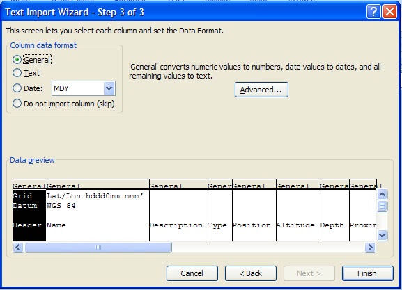
| JPEG File TxtStep3ColumnFormat2.jpg The Excel Import column format after all the columns have been highlighted and the format has been changed to "Text" rather than "General" | Oct 05, 2011 by Krista White | |
|
Labels
|
||
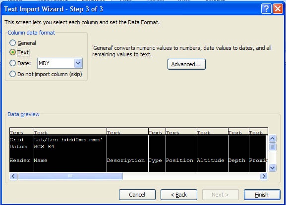
| JPEG File TxtStep3ColumnFormat1.jpg Demonstrates what the Step 3 column format looks like if left with the default format "General." | Oct 05, 2011 by Krista White | |
|
Labels
|
||
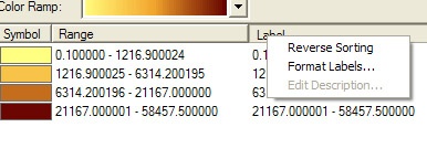
| JPEG File SymbologyLabelFormat.jpg | Jul 19, 2010 by Krista White | |
|
Labels
|
||
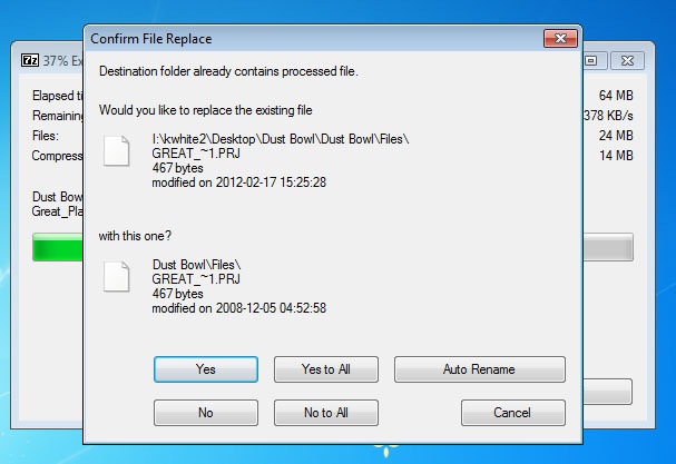
| JPEG File SDCDustBowlUnzipReplaceDialog.jpg An image showing the dialog box asking if users want to replace an already existing file. The answer is NO. | Mar 26, 2012 by Krista White | |
|
Labels
|
||
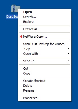
| JPEG File SDCDustBowlUnzip.jpg Image illustrating how to begin the unzip process on a file | Mar 21, 2012 by Krista White | |
|
Labels
|
||
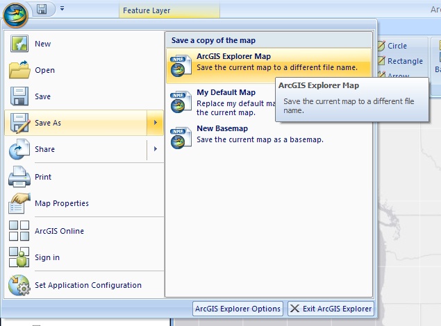
| JPEG File SDCDustBowlSaveArcGISExplorerMap.jpg image of the save process for saving a map in ArcGIS Explorer | Mar 23, 2012 by Krista White | |
|
Labels
|
||
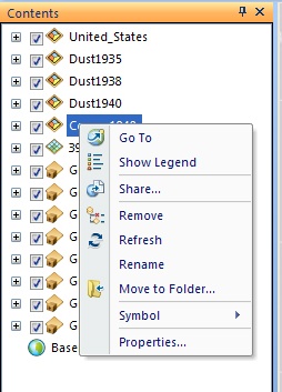
| JPEG File SDCDustBowlRemoveLayer.jpg image illustrating the process for removing a layer from ArcGIS Explorer | Mar 21, 2012 by Krista White | |
|
Labels
|
||
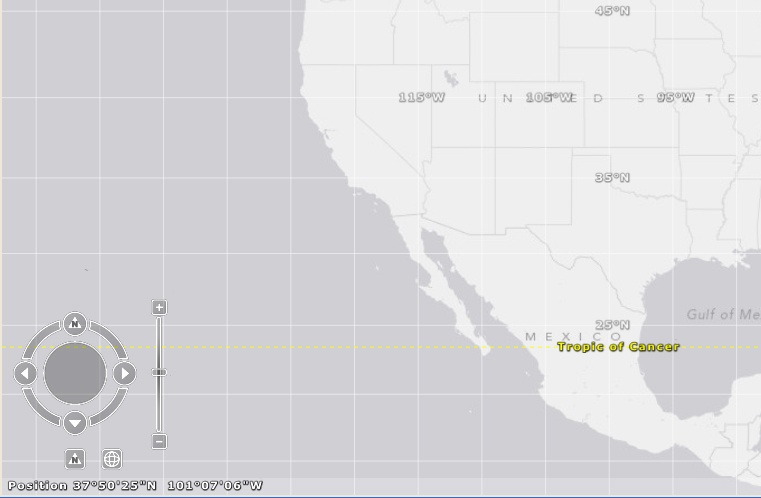
| JPEG File SDCDustBowlNavMaxi.jpg image illustrating how the navigation widget looks in ArcGIS Explorer once you've rolled the mouse over it | Mar 21, 2012 by Krista White | |
|
Labels
|
||
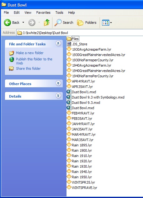
| JPEG File SDCDustBowlMainList.jpg image demonstrating the set of files in the Dust Bowl tutorial folder | Mar 21, 2012 by Krista White | |
|
Labels
|
||
| JPEG File SDCDustBowlLayerOnOff.jpg image illustrating how check boxes turn layers on and off in ArcGIS Explorer | Mar 21, 2012 by Krista White | |
|
Labels
|
||
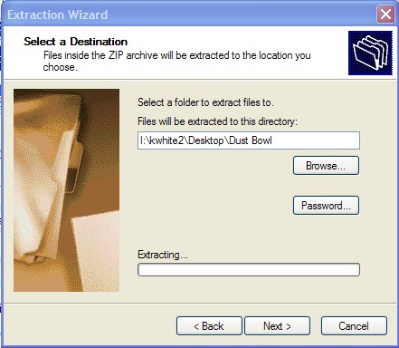
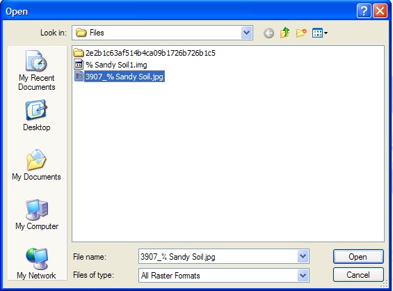
| JPEG File SDCDustBowlExtractionWizardLocation.jpg image showing the extraction wizard with the location to where zipped files will be extracted | Mar 21, 2012 by Krista White | |
|
Labels
|
||
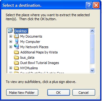
| JPEG File SDCDustBowlExtractionWizardBrowsetoDesktop.jpg image illustrating how to get to the desktop in the unzip process if the file will not extract directly to the desktop | Mar 21, 2012 by Krista White | |
|
Labels
|
||
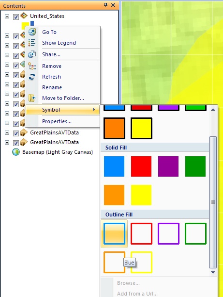
| JPEG File SDCDustBowlChngSymbolOutline.jpg Image demonstrating how to change the symbology of a shapefile to an outline fill instead of a solid shape | Mar 21, 2012 by Krista White | |
|
Labels
|
||
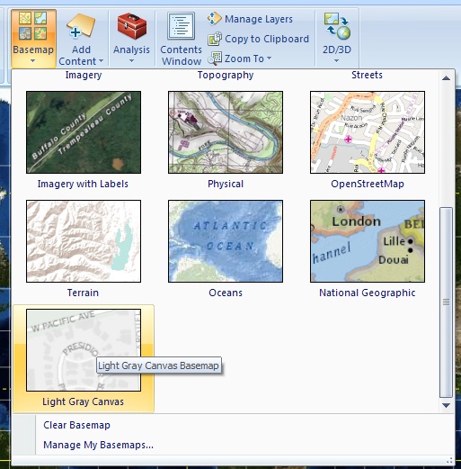
| JPEG File SDCDustBowlArcExpChangeBasemap.jpg Image illustrating how to change the basemap in an ArcGIS Explorer map | Mar 21, 2012 by Krista White | |
|
Labels
|
||
| JPEG File SDCDustBowlAddSoilRaster.jpg Image demonstrating where the Soil Layer for the Dust Bowl tutorial is located in the file set | Mar 21, 2012 by Krista White | |
|
Labels
|
||
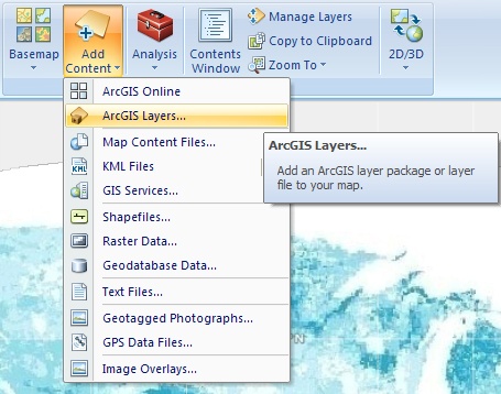
| JPEG File SDCDustBowlAddLayers.jpg Image to demonstrate how to Add Layers to an ArcGIS Explorer map | Mar 21, 2012 by Krista White | |
|
Labels
|
||
| JPEG File SDCArcGISExplorerIcon.jpg The desktop icon for ArcGIS Explorer Desktop | Mar 21, 2012 by Krista White | |
|
Labels
|
||
| JPEG File RepairDataSource.jpg | Jul 19, 2010 by Krista White | |
|
Labels
|
||
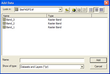
| JPEG File RasterBandLayers.jpg Layer Bands of a Raster Image | Aug 02, 2010 by Krista White | |
|
Labels
|
||
| JPEG File LapReadInstallFSecure.jpg Open Application Explorer Window with the FSecure Installation icon highlighted | Jan 25, 2012 by Krista White | |
|
Labels
|
||
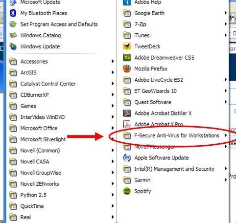
| JPEG File LapReadFSecureAllPrograms.jpg Screen shot of the All Programs menu on a PC with the F-Secure folder highlighted | Jan 25, 2012 by Krista White | |
|
Labels
|
||
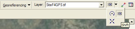
| JPEG File GRShiftTool.jpg Georeferencing Shift Tool | Aug 02, 2010 by Krista White | |
|
Labels
|
||
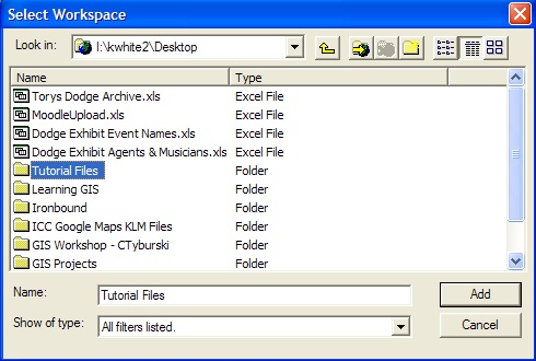
| JPEG File GRSelectWorkspace.jpg Navigation example to show how to add a location to the workspace to save georeferenced files | Aug 09, 2010 by Krista White | |
|
Labels
|
||
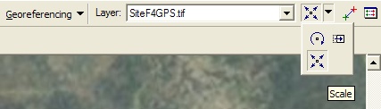
| JPEG File GRScaleTool.jpg Georeferencing Scale Tool | Aug 02, 2010 by Krista White | |
|
Labels
|
||
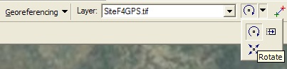
| JPEG File GRRotateTool.jpg Georeferencing Rotate Tool | Aug 02, 2010 by Krista White | |
|
Labels
|
||
| JPEG File GRRectifySaveAs.jpg Georeferencing Save As dialog box for saving the georeferenced image file | Aug 09, 2010 by Krista White | |
|
Labels
|
||
| JPEG File GRAddControlPointsbutton.jpg Add Control Points Button | Aug 02, 2010 by Krista White | |
|
Labels
|
||
| JPEG File GoogleEarthSetupIcon.jpg Google Earth Setup Icon | Jul 27, 2010 by Krista White | |
|
Labels
|
||
| JPEG File GoogleEarthDesktopIcon.jpg Google Earth Desktop Icon | Jul 27, 2010 by Krista White | |
|
Labels
|
||
| JPEG File GEZoomSlider.jpg Google Earth Zoom Slider | Jul 27, 2010 by Krista White | |
|
Labels
|
||
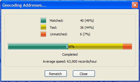
| JPEG File GeoCodResultDialog.jpg Geocoding Addresses dialog box with geocoding result and unmatched tied addresses | Jun 02, 2011 by Krista White | |
|
Labels
|
||
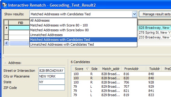
| JPEG File GeoCodRematchShowResultsSelection.jpg Geocoding Interactive Rematch dialog box with the Show results pull down menu expanded | Jun 02, 2011 by Krista White | |
|
Labels
|
||
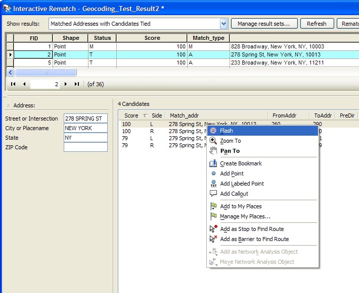
| JPEG File GeoCodRematchFlashCandidate.jpg Geocoding Interactive Rematch dialog box with a candidate highlighted and right-clicked to reveal the Flash option | Jun 02, 2011 by Krista White | |
|
Labels
|
||
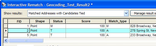
| JPEG File GeoCodReconcileSelectRecord.jpg Geocoding Interactive Rematch dialog box with a single record highlighted under Show results | Jun 02, 2011 by Krista White | |
|
Labels
|
||
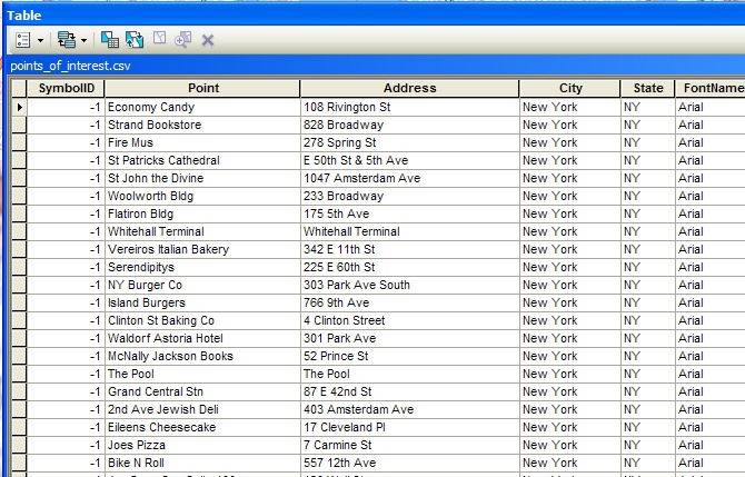
| JPEG File GeoCodPointsofInterestTable.jpg Geocoding Points of Interest Table opened | Jun 03, 2011 by Krista White | |
|
Labels
|
||
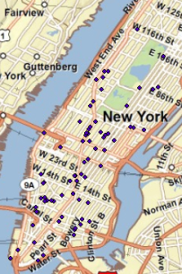
| PNG File GeoCodPoIGeocodedResults.png Geocoded Points of Interest showing on the Manhattan Street basemap | Jun 03, 2011 by Krista White | |
|
Labels
|
||
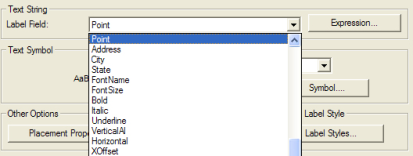
| PNG File GeoCodLabelPoints.png Geocoded Points of Interest Labeling for names mislabeled as "points" | Jun 03, 2011 by Krista White | |
|
Labels
|
||
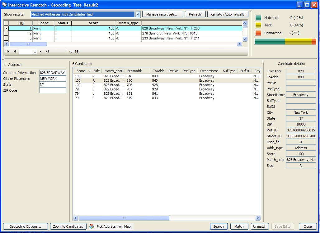
| JPEG File GeoCodInteractiveRematchDialog.jpg Geocoding Interactive Rematch dialog box | Jun 02, 2011 by Krista White | |
|
Labels
|
||
| PNG File GENZoomInDemo.png Zoom In demonstration of how to click and drag with zoom in button | Jun 03, 2011 by Krista White | |
|
Labels
|
||
| PNG File GENZoomInButton.png Zoom In button | Jun 03, 2011 by Krista White | |
|
Labels
|
||
| PNG File GENSaveMap.png Save Map dialog box | Jun 03, 2011 by Krista White | |
|
Labels
|
||
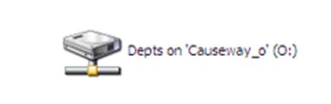
| JPEG File GENODrive.jpg O Drive image | Jun 03, 2011 by Krista White | |
|
Labels
|
||
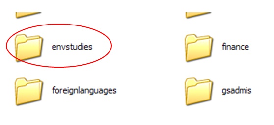
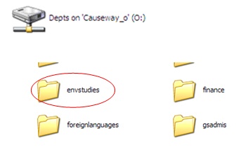
| JPEG File GENEnvStudiesFolderODrive.jpg Environmental Studies Folder image | Jun 03, 2011 by Krista White | |
|
Labels
|
||
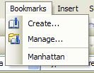
| PNG File GENBookmarkCreated.png Bookmark menu with a bookmark called Manhattan added | Jun 03, 2011 by Krista White | |
|
Labels
|
||
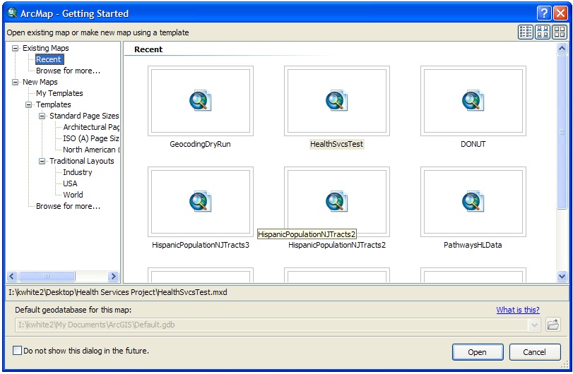
| JPEG File GENArcMapGetStarteddialog.jpg ArcMap 10 Getting Started dialog box for choosing existing or new map project documents | Jun 03, 2011 by Krista White | |
|
Labels
|
||
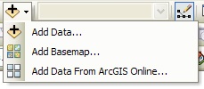
| JPEG File GENAddDataButton.jpg Add Data Button with menu expanded | Jun 03, 2011 by Krista White | |
|
Labels
|
||
| JPEG File GEMoveJoystick.jpg Google Earth Move Joystick | Jul 27, 2010 by Krista White | |
|
Labels
|
||
| JPEG File GELookJoystick.jpg Google Earth Look Joystick | Jul 27, 2010 by Krista White | |
|
Labels
|
||
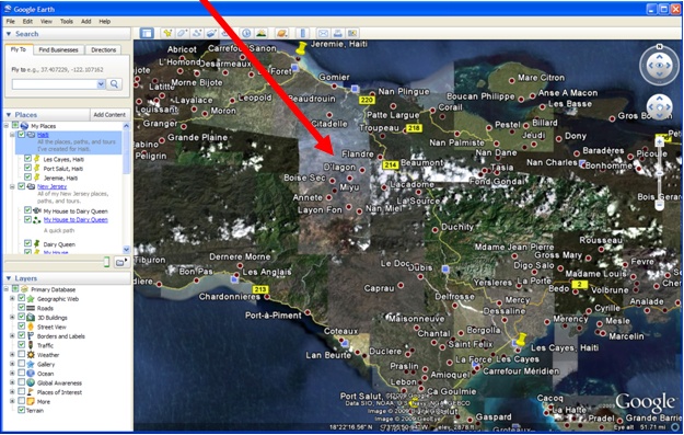
| JPEG File GE3DViewer.jpg Google Earth 3D Viewer - the main screen | Jul 27, 2010 by Krista White | |
|
Labels
|
||
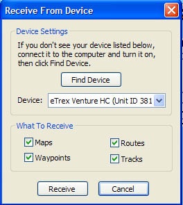
| JPEG File eTrexRecieveDeviceDialog.jpg Garmin eTrex Venture Trip and Waypoint Manager software showing the Recieve from Device dialog box with desired settings in place | Oct 05, 2011 by Krista White | |
|
Labels
|
||
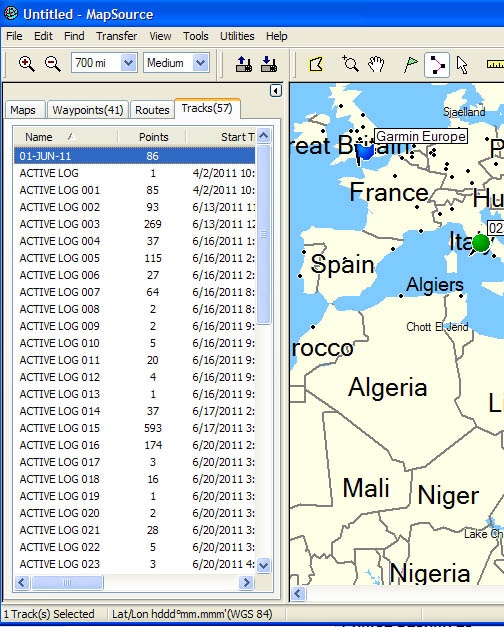
| JPEG File eTrexImportedData.jpg Garmin eTrex Venture unit data displayed in the tabs of the MapSource Trip and Waypoint Manager software | Oct 05, 2011 by Krista White | |
|
Labels
|
||
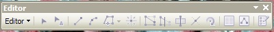
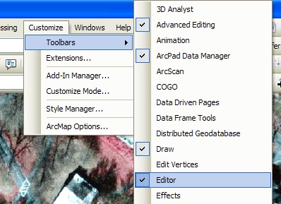
| JPEG File EditorToolbar.jpg ArcMap Editor Toolbar | Jun 15, 2011 by Krista White | |
|
Labels
|
||
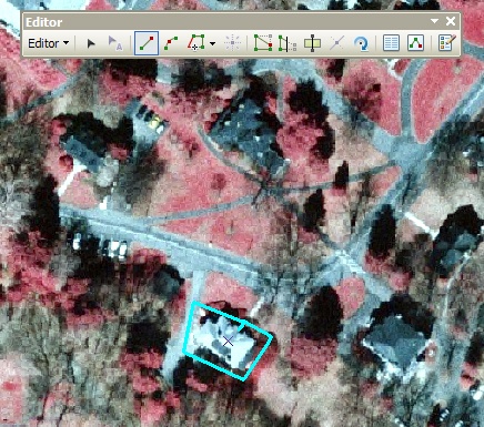
| JPEG File DFeatProperlyDigitized.jpg Image displaying a digitized polygon that has been successfully added to the Shapefile | Jun 15, 2011 by Krista White | |
|
Labels
|
||
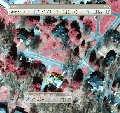
| JPEG File DFeatDigitizePolygon.jpg Image of the digitization/creation process for a Polygon Feature | Jun 16, 2011 by Krista White | |
|
Labels
|
||
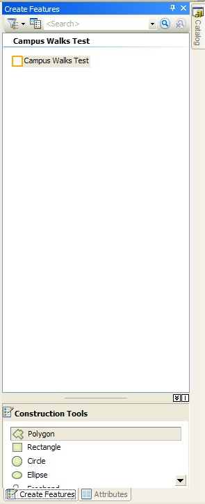
| JPEG File DFeatCreateFeaturesMenu.jpg Create Features Menu in Editor functions | Jun 15, 2011 by Krista White | |
|
Labels
|
||
| JPEG File DFeatAddEditorToolbar.jpg Add the Editor Toolbar to the Tools set in ArcMap | Jun 15, 2011 by Krista White | |
|
Labels
|
||
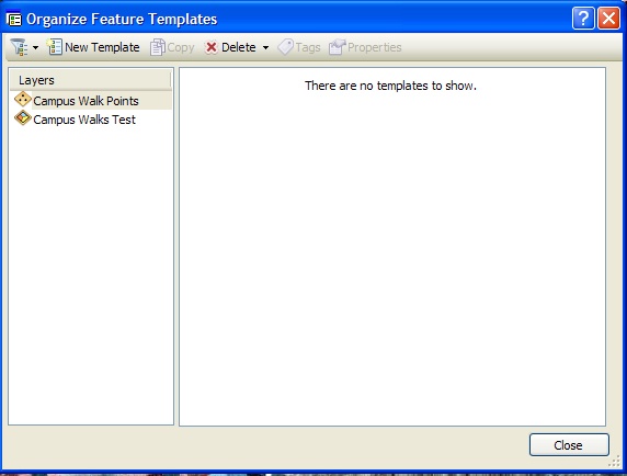
| JPEG File DFeaOrganizeTemplatesdialog.jpg ArcMap 10 Editor Tool Organize Templates dialog box with a layer highlighted that is not showing up in the Create Feature menu of the Editor window | Jun 16, 2011 by Krista White | |
|
Labels
|
||
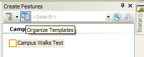
| JPEG File DFeaOrganizeTemplatesbutton.jpg ArcMap 10 Editor Tool Organize Templates button | Jun 16, 2011 by Krista White | |
|
Labels
|
||
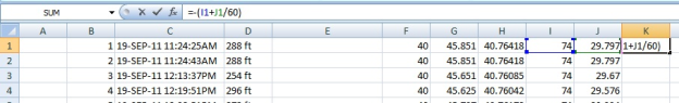
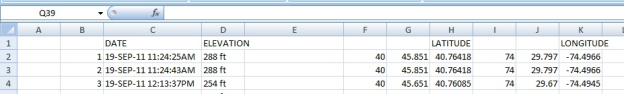
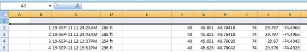
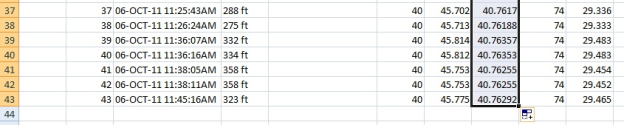
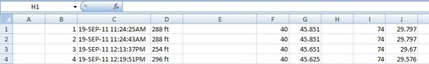
| PNG File DecDegMinusOneforWesternLongitude.png imported from a Word document | Dec 19, 2011 by Krista White | |
|
Labels
|
||
| PNG File DecDegLabelRows.png imported from a Word document | Dec 19, 2011 by Krista White | |
|
Labels
|
||
| PNG File DecDegInsertRow.png imported from a Word document | Dec 19, 2011 by Krista White | |
|
Labels
|
||
| PNG File DecDegFormulaFinished.png imported from a Word document | Dec 19, 2011 by Krista White | |
|
Labels
|
||
| PNG File DecDegEliminateCompassLetters.png imported from a Word document | Dec 19, 2011 by Krista White | |
|
Labels
|
||
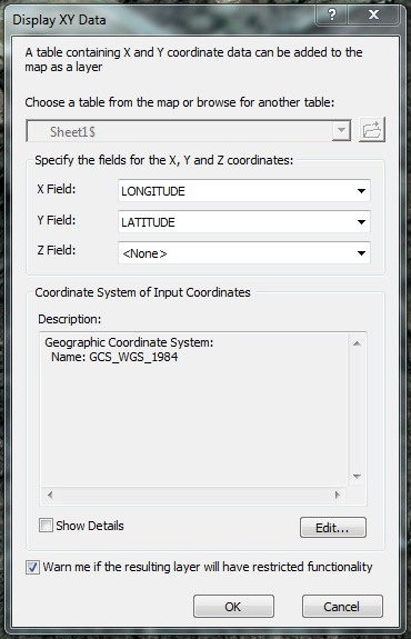
| PNG File DecDegDisplayXYData.png imported from a Word document | Dec 19, 2011 by Krista White | |
|
Labels
|
||
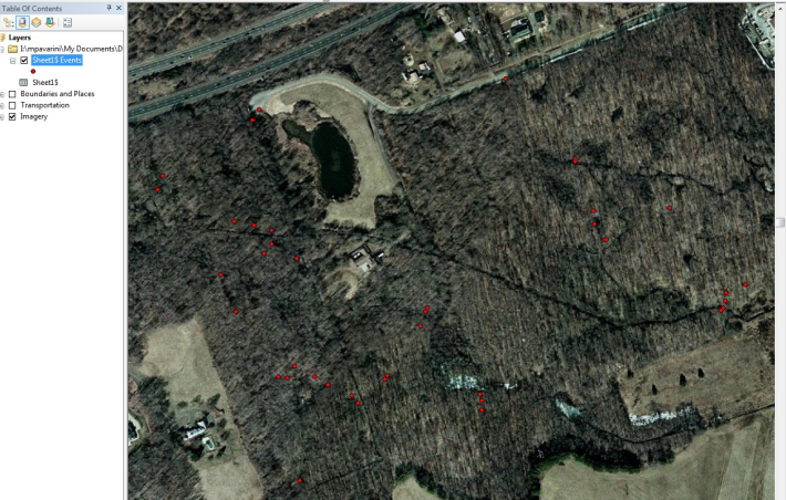
| PNG File DecDegDigitizedXYDataonMap.png imported from a Word document | Dec 19, 2011 by Krista White | |
|
Labels
|
||
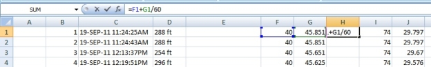
| PNG File DecDegCreateForumula.png imported from a Word document | Dec 19, 2011 by Krista White | |
|
Labels
|
||
| PNG File DecDegCreateBreakline.png imported from a Word document | Dec 19, 2011 by Krista White | |
|
Labels
|
||
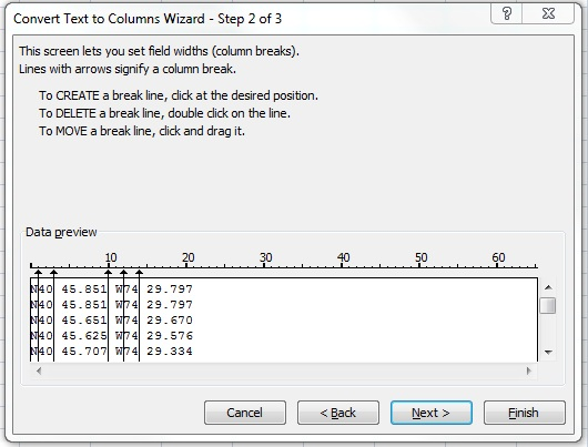
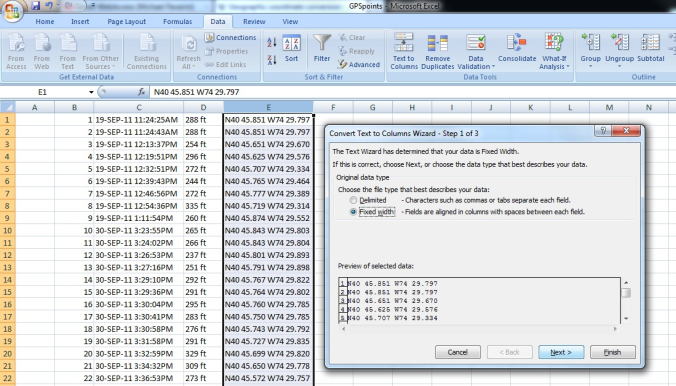
| PNG File DecDegConvertTexttoColumns.png imported from a Word document | Dec 19, 2011 by Krista White | |
|
Labels
|
||
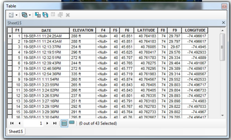
| PNG File DecDegAddedTableinArcMap.png imported from a Word document | Jan 23, 2012 by Krista White | |
|
Labels
|
||
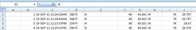
| PNG File DecDeg6SeparateColumns.png imported from a Word document | Dec 19, 2011 by Krista White | |
|
Labels
|
||
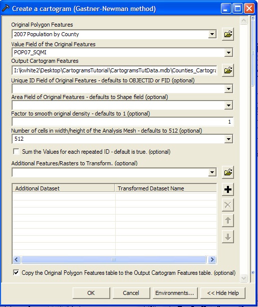
| JPEG File CreateCartoDialog.jpg | Jul 19, 2010 by Krista White | |
|
Labels
|
||
| JPEG File CopyFilesODrive.jpg | Jul 19, 2010 by Krista White | |
|
Labels
|
||
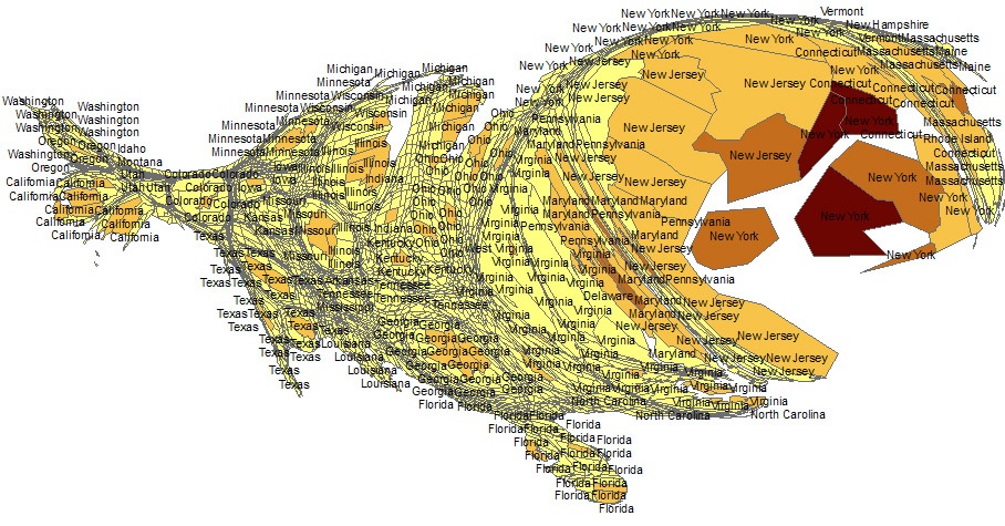
| JPEG File Carto2007PopDensity.jpg | Jul 19, 2010 by Krista White | |
|
Labels
|
||
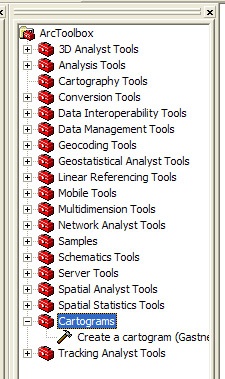
| JPEG File ArcToolCartograms.jpg | Jul 19, 2010 by Krista White | |
|
Labels
|
||
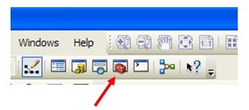
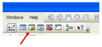
| JPEG File ArcToolboxbutton.jpg ArcToolbox button highlighted with a red arrow in the context of other tools buttons on the ArcMap toolbar | Jun 03, 2011 by Krista White | |
|
Labels
|
||
| JPEG File ArcMapIcon.jpg | Jun 03, 2011 by Krista White | |
|
Labels
|
||
| JPEG File ArcGISAppXDowloading.jpg ArcGIS 9.3 SP1 Icon indicating downloading from Application Explorer | Jul 27, 2010 by Krista White | |
|
Labels
|
||
| JPEG File ArcGISAppXDowloaded.jpg ArcGIS Dowload complete from Application Explorer | Jul 27, 2010 by Krista White | |
|
Labels
|
||
| JPEG File ArcGIS93SP1Icon.jpg ArcGIS 9.3 SP1 Icon in the Application Explorer | Jul 27, 2010 by Krista White | |
|
Labels
|
||
| JPEG File ArcCatalogIcon.jpg ArcCatalog 10 Icon | Jun 03, 2011 by Krista White | |
|
Labels
|
||
| JPEG File ArcCatalogbutton.jpg ArcCatalog button highlighted with a red arrow in the context of other tools buttons on the ArcMap toolbar | Jun 03, 2011 by Krista White | |
|
Labels
|
||
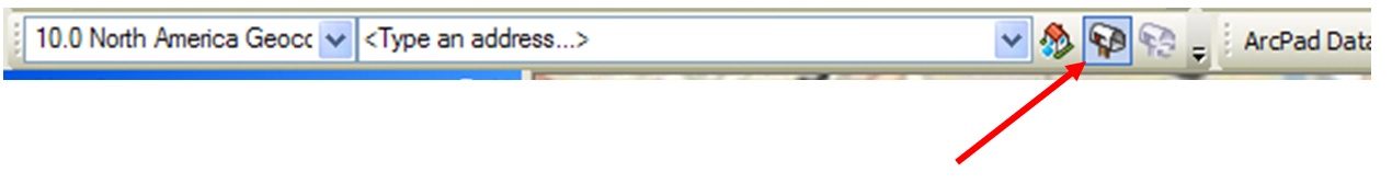
| JPEG File Arc10GeocodingButton.jpg Geocoding Toolbar in ArcMap 10 with Geocoing Button depressed and highlighted with an arrow | Jun 02, 2011 by Krista White | |
|
Labels
|
||
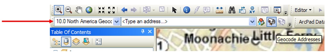
| JPEG File Arc10GeocdTBarHiLite.jpg Geocoding Toolbar in ArcMap 10 with arrow pointing to highlight its location | Jun 02, 2011 by Krista White | |
|
Labels
|
||
| JPEG File appxplorer_icon.jpg Application Explorer Desktop Icon | Jul 27, 2010 by Krista White | |
|
Labels
|
||
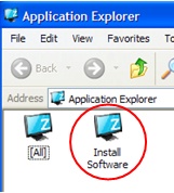
| JPEG File AppXInstallSoftware.jpg Application Explorer Install Software Icon | Jul 27, 2010 by Krista White | |
|
Labels
|
||
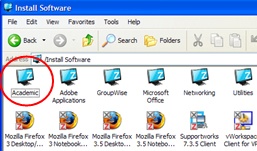
| JPEG File AppXAcademicFolder.jpg Application Explorer Academic Folder Icon | Jul 27, 2010 by Krista White | |
|
Labels
|
||
- No labels
2 Comments
Anonymous
Very well written, I’m glad I stumbled onto this. My friend and I were just having a similar disussion the other day.
Anonymous