| |
Name
|
Size
|
Creator |
Creation Date
|
Labels |
|
|
|
PNG File
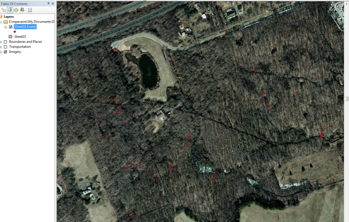
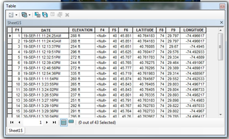
DecDegDigitizedXYDataonMap.png
|
737 kB |
Krista White |
Dec 19, 2011 15:28 |
|
|
| |
Version 1 (current)
|
737 kB |
Krista White |
Dec 19, 2011 15:28 |
|
|
|
|
JPEG File
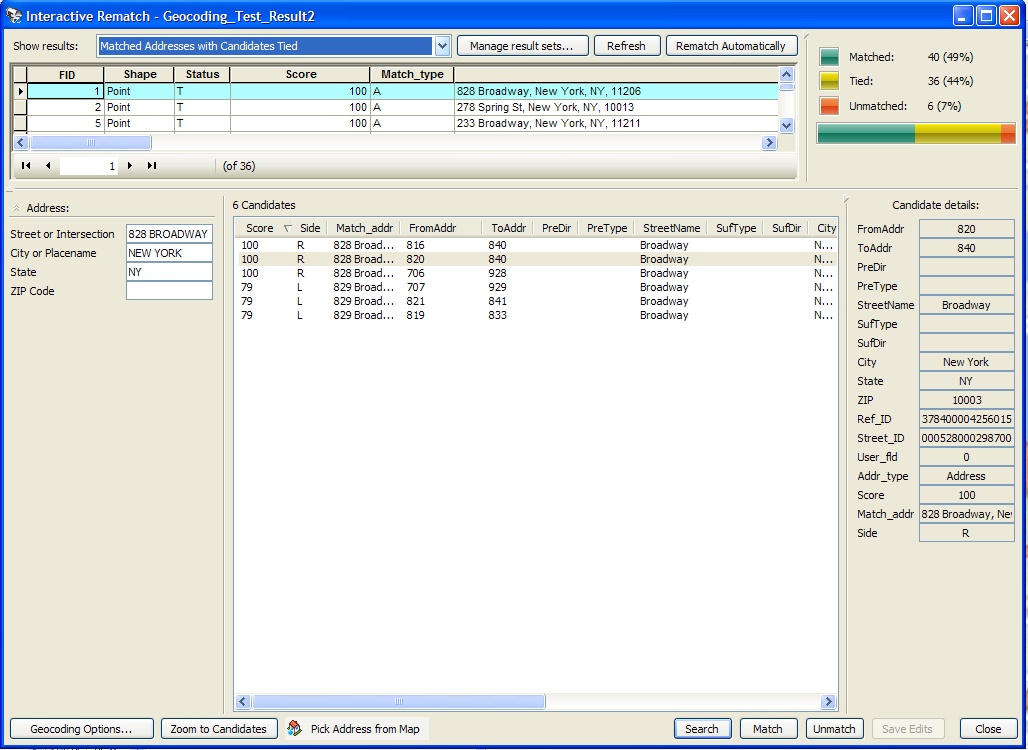
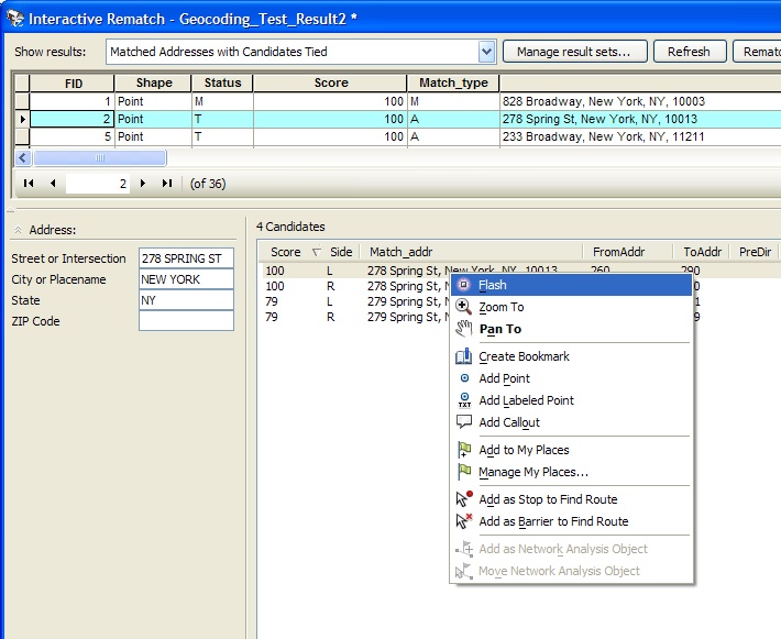
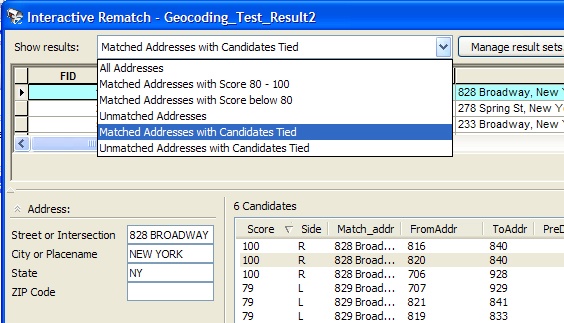
GeoCodInteractiveRematchDialog.jpg
|
445 kB |
Krista White |
Jun 02, 2011 15:50 |
|
|
| |
Version 1 (current)
|
445 kB |
Krista White |
Jun 02, 2011 15:50 |
|
|
|
|
PNG File
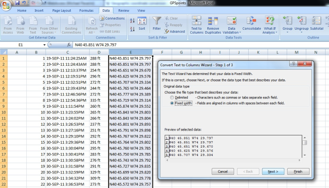
DecDegConvertTexttoColumns.png
|
369 kB |
Krista White |
Dec 19, 2011 15:28 |
|
|
| |
Version 1 (current)
|
369 kB |
Krista White |
Dec 19, 2011 15:28 |
|
|
|
|
JPEG File
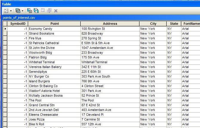
GeoCodPointsofInterestTable.jpg
|
364 kB |
Krista White |
Jun 03, 2011 10:31 |
|
|
| |
Version 1 (current)
|
364 kB |
Krista White |
Jun 03, 2011 10:31 |
|
|
|
|
JPEG File
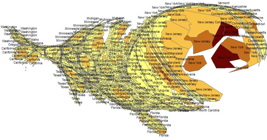
Carto2007PopDensity.jpg
|
334 kB |
Krista White |
Jul 19, 2010 13:23 |
|
|
| |
Version 1 (current)
|
334 kB |
Krista White |
Jul 19, 2010 13:23 |
|
|
|
|
JPEG File
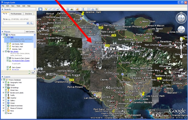
GE3DViewer.jpg
|
304 kB |
Krista White |
Jul 27, 2010 16:43 |
|
|
| |
Version 1 (current)
|
304 kB |
Krista White |
Jul 27, 2010 16:43 |
|
|
|
|
JPEG File
GeoCodRematchFlashCandidate.jpg
|
279 kB |
Krista White |
Jun 02, 2011 16:11 |
|
|
| |
Version 1 (current)
|
279 kB |
Krista White |
Jun 02, 2011 16:11 |
|
|
|
|
JPEG File
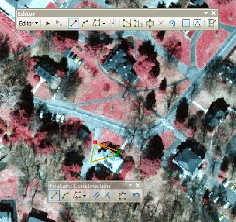
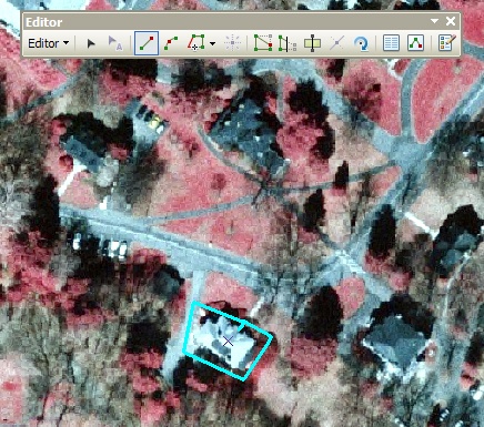
DFeatDigitizePolygon.jpg
|
279 kB |
Krista White |
Jun 16, 2011 08:43 |
|
|
| |
Version 1 (current)
|
279 kB |
Krista White |
Jun 16, 2011 08:43 |
|
|
|
|
JPEG File
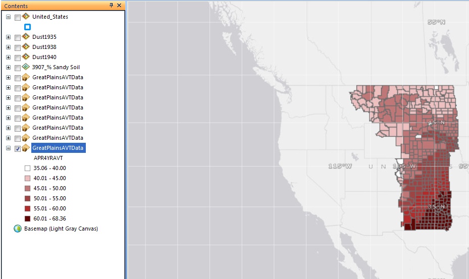
SDCDustBowlLayerOnOff.jpg
|
257 kB |
Krista White |
Mar 21, 2012 15:30 |
|
|
| |
Version 1 (current)
|
257 kB |
Krista White |
Mar 21, 2012 15:30 |
|
|
|
|
JPEG File
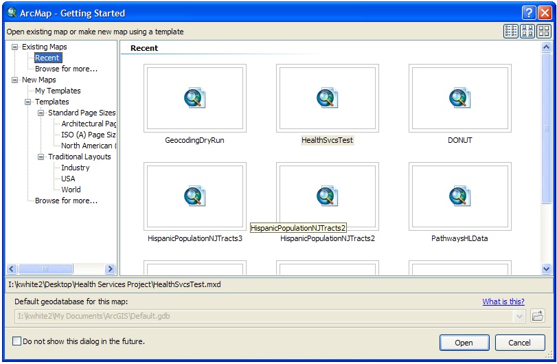
GENArcMapGetStarteddialog.jpg
|
251 kB |
Krista White |
Jun 03, 2011 09:39 |
|
|
| |
Version 1 (current)
|
251 kB |
Krista White |
Jun 03, 2011 09:39 |
|
|
|
|
JPEG File
SDCDustBowlMainList.jpg
|
250 kB |
Krista White |
Mar 21, 2012 15:30 |
|
|
| |
Version 1 (current)
|
250 kB |
Krista White |
Mar 21, 2012 15:30 |
|
|
|
|
JPEG File
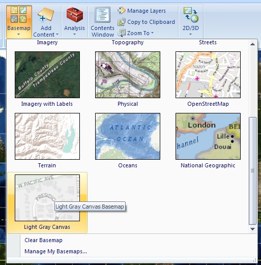
SDCDustBowlArcExpChangeBasemap.jpg
|
244 kB |
Krista White |
Mar 21, 2012 15:28 |
|
|
| |
Version 1 (current)
|
244 kB |
Krista White |
Mar 21, 2012 15:28 |
|
|
|
|
JPEG File
DFeatProperlyDigitized.jpg
|
240 kB |
Krista White |
Jun 15, 2011 15:47 |
|
|
| |
Version 1 (current)
|
240 kB |
Krista White |
Jun 15, 2011 15:47 |
|
|
|
|
JPEG File
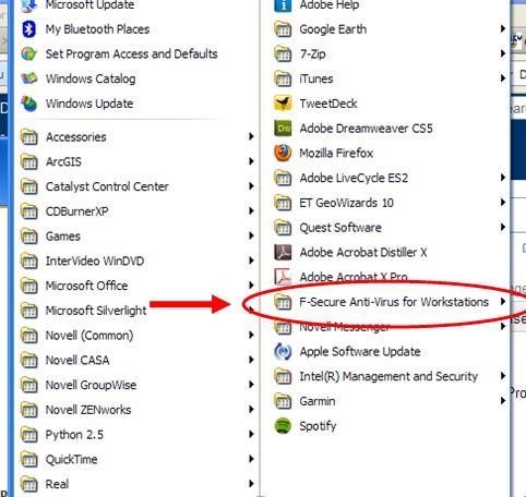
LapReadFSecureAllPrograms.jpg
|
207 kB |
Krista White |
Jan 25, 2012 10:10 |
|
|
| |
Version 1 (current)
|
207 kB |
Krista White |
Jan 25, 2012 10:10 |
|
|
|
|
JPEG File
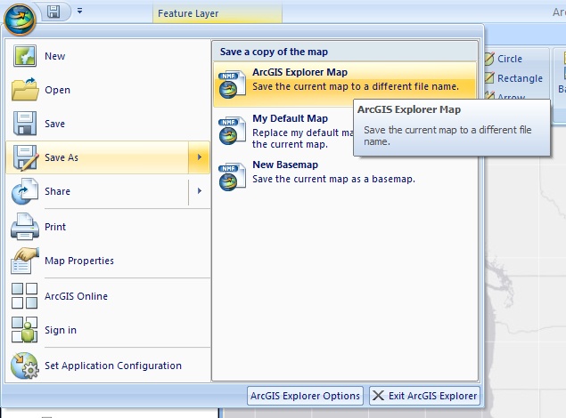
SDCDustBowlSaveArcGISExplorerMap.jpg
|
206 kB |
Krista White |
Mar 23, 2012 10:32 |
|
|
| |
Version 1 (current)
|
206 kB |
Krista White |
Mar 23, 2012 10:32 |
|
|
|
|
PNG File
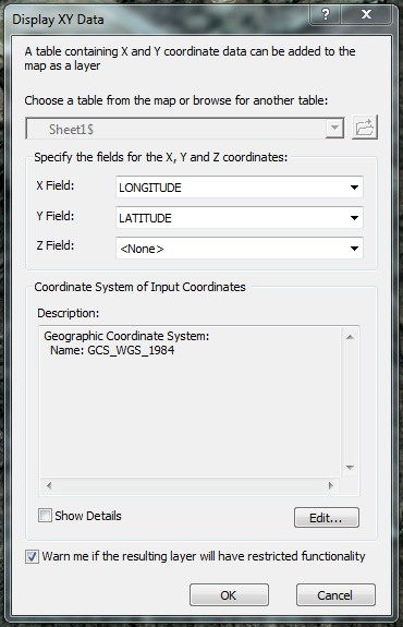
DecDegDisplayXYData.png
|
202 kB |
Krista White |
Dec 19, 2011 15:28 |
|
|
| |
Version 1 (current)
|
202 kB |
Krista White |
Dec 19, 2011 15:28 |
|
|
|
|
PNG File
DecDegAddedTableinArcMap.png
|
196 kB |
Krista White |
Dec 19, 2011 15:28 |
|
|
| |
Version 1 (current)
|
196 kB |
Krista White |
Dec 19, 2011 15:28 |
|
|
|
|
JPEG File
GeoCodRematchShowResultsSelection.jpg
|
195 kB |
Krista White |
Jun 02, 2011 15:50 |
|
|
| |
Version 1 (current)
|
195 kB |
Krista White |
Jun 02, 2011 15:50 |
|
|
|
|
JPEG File
SDCDustBowlChngSymbolOutline.jpg
|
185 kB |
Krista White |
Mar 21, 2012 15:28 |
|
|
| |
Version 1 (current)
|
185 kB |
Krista White |
Mar 21, 2012 15:28 |
|
|
|
|
PNG File
GeoCodPoIGeocodedResults.png
|
176 kB |
Krista White |
Jun 03, 2011 11:13 |
|
|
| |
Version 1 (current)
|
176 kB |
Krista White |
Jun 03, 2011 11:13 |
|
|