| Name | Size | Creator | Creation Date | Labels | Comment | ||
|---|---|---|---|---|---|---|---|
| JPEG File SDCDustBowlAddLayers.jpg | 175 kB | Krista White | Mar 21, 2012 15:28 |
|
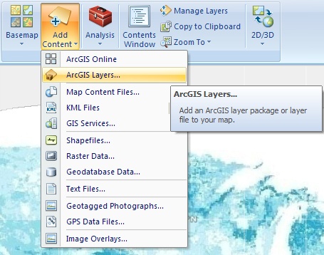
Image to demonstrate how to Add Layers to an ArcGIS Explorer map | ||
| Version 1 (current) | 175 kB | Krista White | Mar 21, 2012 15:28 | Image to demonstrate how to Add Layers to an ArcGIS Explorer map | |||
| JPEG File LapReadInstallFSecure.jpg | 174 kB | Krista White | Jan 25, 2012 10:18 |
|
Open Application Explorer Window with the FSecure Installation icon highlighted | ||
| Version 1 (current) | 174 kB | Krista White | Jan 25, 2012 10:18 | Open Application Explorer Window with the FSecure Installation icon highlighted | |||
| JPEG File SDCDustBowlExtractionWizardLocation.jpg | 173 kB | Krista White | Mar 21, 2012 15:30 |
|
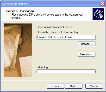
image showing the extraction wizard with the location to where zipped files will be extracted | ||
| Version 1 (current) | 173 kB | Krista White | Mar 21, 2012 15:30 | image showing the extraction wizard with the location to where zipped files will be extracted | |||
| JPEG File CreateCartoDialog.jpg | 164 kB | Krista White | Jul 19, 2010 13:22 |
|
|||
| Version 1 (current) | 164 kB | Krista White | Jul 19, 2010 13:22 | ||||
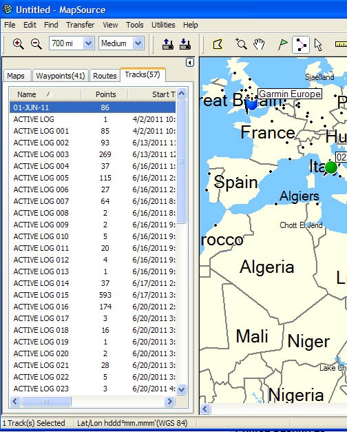
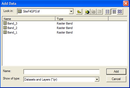
| JPEG File eTrexImportedData.jpg | 159 kB | Krista White | Oct 05, 2011 11:21 |
|
Garmin eTrex Venture unit data displayed in the tabs of the MapSource Trip and Waypoint Manager software | ||
| Version 1 (current) | 159 kB | Krista White | Oct 05, 2011 11:21 | Garmin eTrex Venture unit data displayed in the tabs of the MapSource Trip and Waypoint Manager software | |||
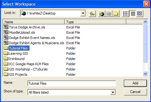
| JPEG File GRSelectWorkspace.jpg | 157 kB | Krista White | Aug 09, 2010 10:57 |
|
Navigation example to show how to add a location to the workspace to save georeferenced files | ||
| Version 1 (current) | 157 kB | Krista White | Aug 09, 2010 10:57 | Navigation example to show how to add a location to the workspace to save georeferenced files | |||
| JPEG File SDCDustBowlAddSoilRaster.jpg | 146 kB | Krista White | Mar 21, 2012 15:28 |
|
Image demonstrating where the Soil Layer for the Dust Bowl tutorial is located in the file set | ||
| Version 1 (current) | 146 kB | Krista White | Mar 21, 2012 15:28 | Image demonstrating where the Soil Layer for the Dust Bowl tutorial is located in the file set | |||
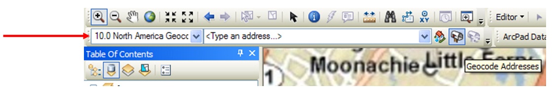
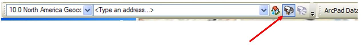
| JPEG File Arc10GeocdTBarHiLite.jpg | 139 kB | Krista White | Jun 02, 2011 14:54 |
|
Geocoding Toolbar in ArcMap 10 with arrow pointing to highlight its location | ||
| Version 1 (current) | 139 kB | Krista White | Jun 02, 2011 14:54 | Geocoding Toolbar in ArcMap 10 with arrow pointing to highlight its location | |||
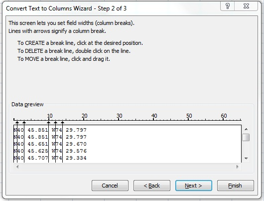
| PNG File DecDegCreateBreakline.png | 138 kB | Krista White | Dec 19, 2011 15:28 |
|
imported from a Word document | ||
| Version 1 (current) | 138 kB | Krista White | Dec 19, 2011 15:28 | imported from a Word document | |||
| JPEG File SDCDustBowlExtractionWizardBrowsetoDesktop.jpg | 138 kB | Krista White | Mar 21, 2012 15:30 |
|
image illustrating how to get to the desktop in the unzip process if the file will not extract directly to the desktop | ||
| Version 1 (current) | 138 kB | Krista White | Mar 21, 2012 15:30 | image illustrating how to get to the desktop in the unzip process if the file will not extract directly to the desktop | |||
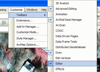
| JPEG File DFeatAddEditorToolbar.jpg | 135 kB | Krista White | Jun 15, 2011 15:30 |
|
Add the Editor Toolbar to the Tools set in ArcMap | ||
| Version 1 (current) | 135 kB | Krista White | Jun 15, 2011 15:30 | Add the Editor Toolbar to the Tools set in ArcMap | |||
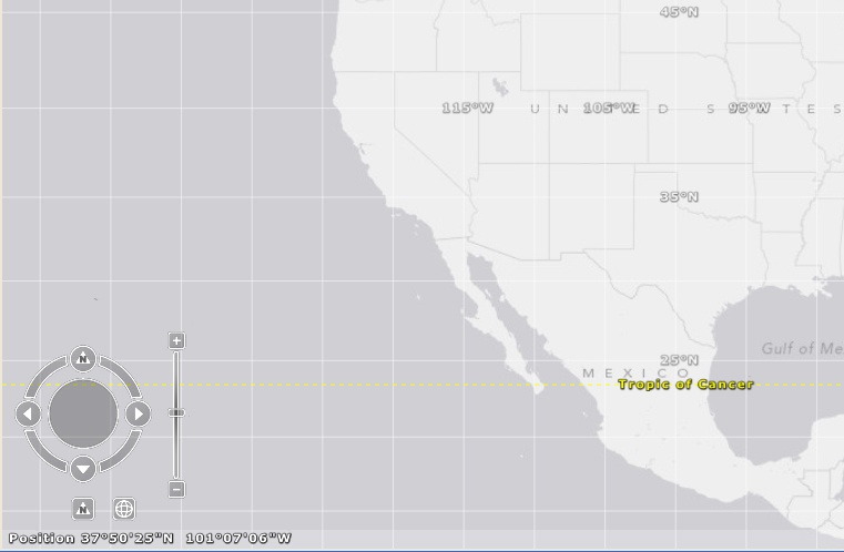
| JPEG File SDCDustBowlNavMaxi.jpg | 122 kB | Krista White | Mar 21, 2012 15:30 |
|
image illustrating how the navigation widget looks in ArcGIS Explorer once you've rolled the mouse over it | ||
| Version 1 (current) | 122 kB | Krista White | Mar 21, 2012 15:30 | image illustrating how the navigation widget looks in ArcGIS Explorer once you've rolled the mouse over it | |||
| JPEG File SDCDustBowlRemoveLayer.jpg | 110 kB | Krista White | Mar 21, 2012 15:31 |
|
image illustrating the process for removing a layer from ArcGIS Explorer | ||
| Version 1 (current) | 110 kB | Krista White | Mar 21, 2012 15:31 | image illustrating the process for removing a layer from ArcGIS Explorer | |||
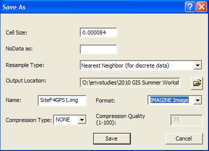
| JPEG File GRRectifySaveAs.jpg | 108 kB | Krista White | Aug 09, 2010 10:57 |
|
Georeferencing Save As dialog box for saving the georeferenced image file | ||
| Version 1 (current) | 108 kB | Krista White | Aug 09, 2010 10:57 | Georeferencing Save As dialog box for saving the georeferenced image file | |||
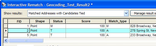
| JPEG File GeoCodReconcileSelectRecord.jpg | 105 kB | Krista White | Jun 02, 2011 16:11 |
|
Geocoding Interactive Rematch dialog box with a single record highlighted under Show results | ||
| Version 1 (current) | 105 kB | Krista White | Jun 02, 2011 16:11 | Geocoding Interactive Rematch dialog box with a single record highlighted under Show results | |||
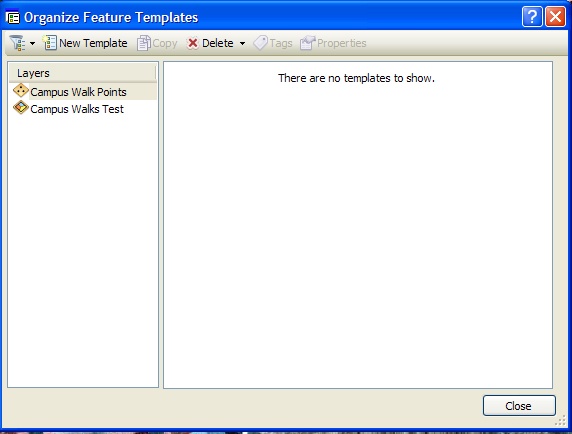
| JPEG File DFeaOrganizeTemplatesdialog.jpg | 104 kB | Krista White | Jun 16, 2011 09:17 |
|
ArcMap 10 Editor Tool Organize Templates dialog box with a layer highlighted that is not showing up in the Create Feature menu of the Editor window | ||
| Version 1 (current) | 104 kB | Krista White | Jun 16, 2011 09:17 | ArcMap 10 Editor Tool Organize Templates dialog box with a layer highlighted that is not showing up in the Create Feature menu of the Editor window | |||
| JPEG File Arc10GeocodingButton.jpg | 99 kB | Krista White | Jun 02, 2011 14:55 |
|
Geocoding Toolbar in ArcMap 10 with Geocoing Button depressed and highlighted with an arrow | ||
| Version 1 (current) | 99 kB | Krista White | Jun 02, 2011 14:55 | Geocoding Toolbar in ArcMap 10 with Geocoing Button depressed and highlighted with an arrow | |||
| PNG File DecDegFormulaFinished.png | 94 kB | Krista White | Dec 19, 2011 15:28 |
|
imported from a Word document | ||
| Version 1 (current) | 94 kB | Krista White | Dec 19, 2011 15:28 | imported from a Word document | |||
| JPEG File RasterBandLayers.jpg | 92 kB | Krista White | Aug 02, 2010 14:10 |
|
Layer Bands of a Raster Image | ||
| Version 1 (current) | 92 kB | Krista White | Aug 02, 2010 14:10 | Layer Bands of a Raster Image | |||
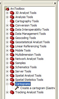
| JPEG File ArcToolCartograms.jpg | 88 kB | Krista White | Jul 19, 2010 13:22 |
|
|||
| Version 1 (current) | 88 kB | Krista White | Jul 19, 2010 13:22 |